![]()
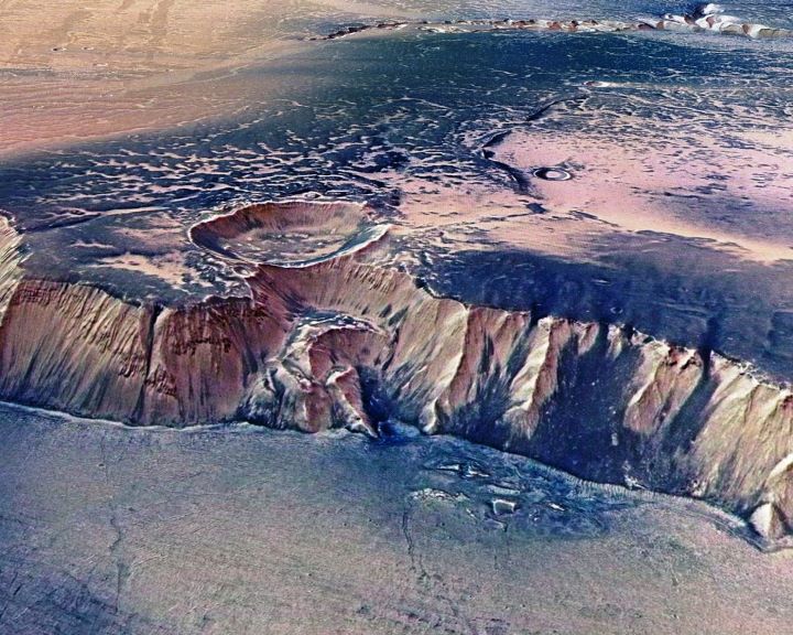
MARS
Mars is the fourth planet from the Sun and the second smallest
planet in the Solar System, after Mercury.
Radius: 3,390 km
Mass: 6.39 × 10^23 kg Distance from Sun: 227.9 million km
Gravity: 3.711 m/s²
Length of day: 1d 0h 40m Moons: Phobos,
Deimos
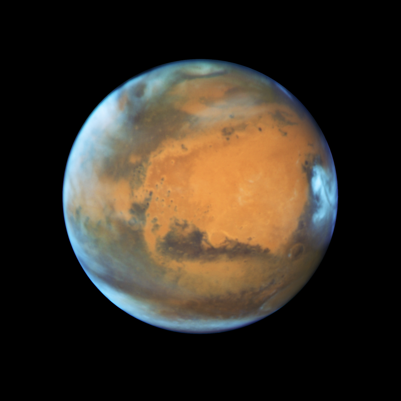
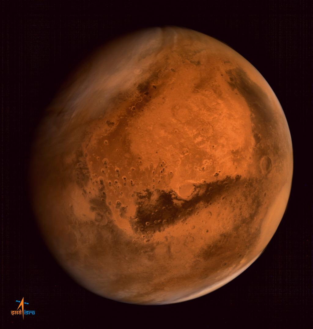
Hubble Image. May 2016
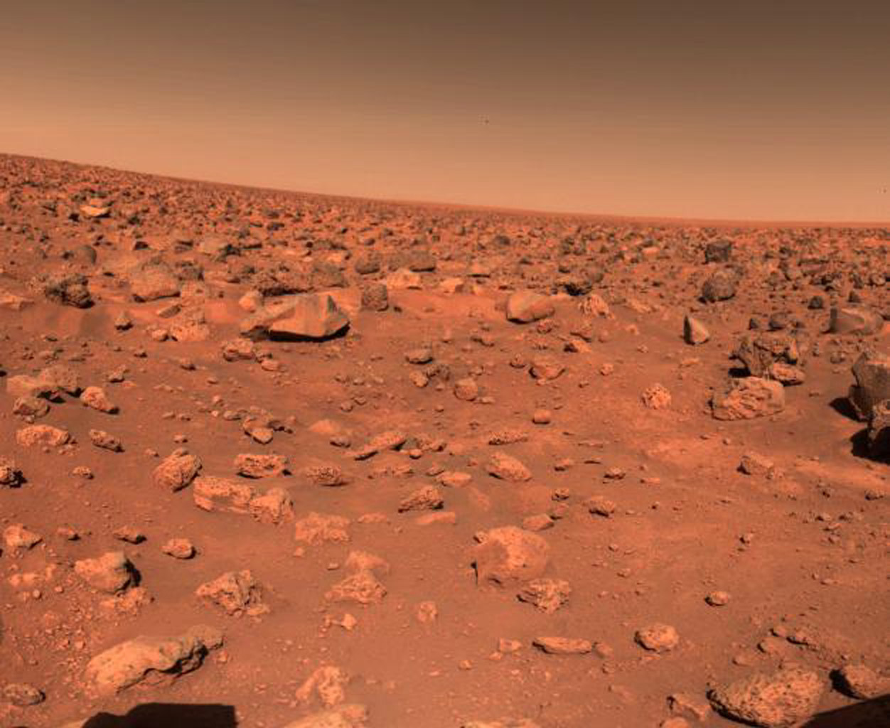 Viking Lander 1976 |
|||||||||||||||||
 Viking Lander 1976 |
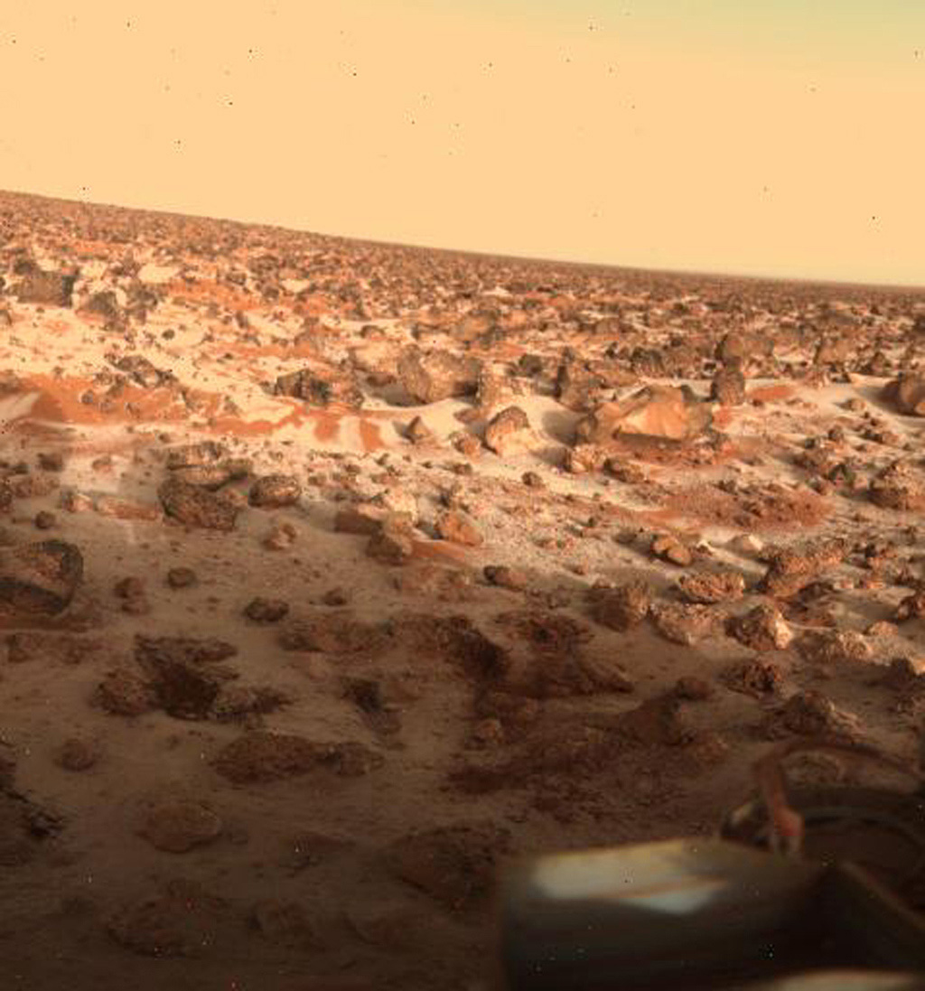
|||||||||||||||||
 Viking Lander 1979 |
|||||||||||||||||
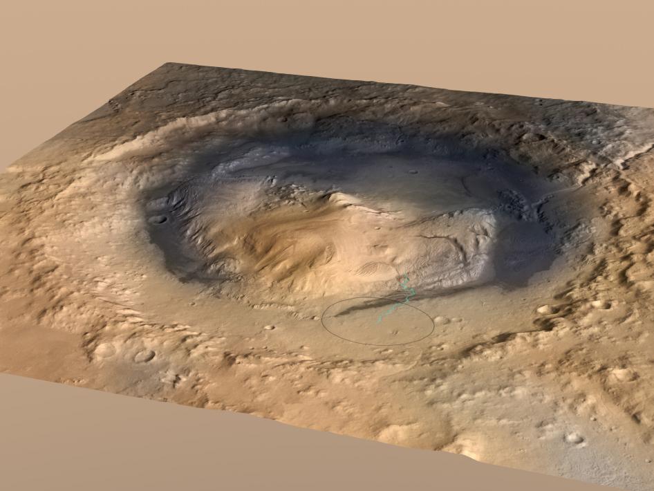
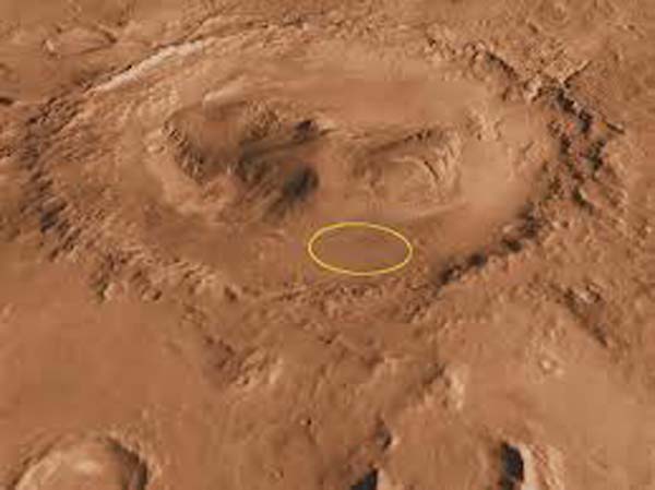 Gale Crater showing the intended landing site, Curiosity landed within the circle. Image: Mars orbiter. |
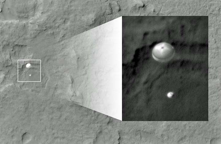 Image captured from orbiter - parachute deployed and down she goes Animation Video of Landing Sequence |
||||||||||||||||
 The original. Curiosity heads down on the parachute. Image: Mars Orbiter |
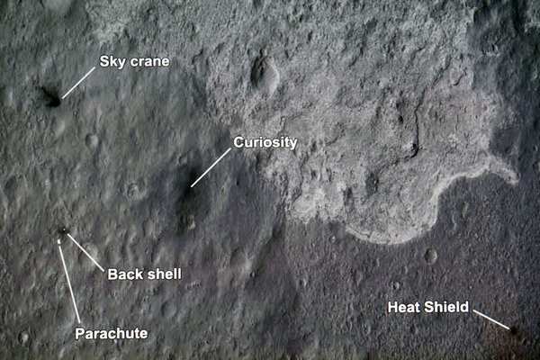
 This image shows a color thumbnail image obtained by NASA's Curiosity rover during its descent to the surface of Mars on Sunday 6th Aug. The image was obtained by the Mars Descent Imager instrument known as MARDI and shows the 15-foot diameter heat shield when it was about 50 feet from the spacecraft. |
||||||||||||||||
 Sky Crane lowers Curiosity to the Planets surface |
 |
||||||||||||||||
 Steve Collins endures the 7 minutes of terror. He was later seen in tears when the news came though - Curiosity had landed safely. |
 That moment! |
||||||||||||||||
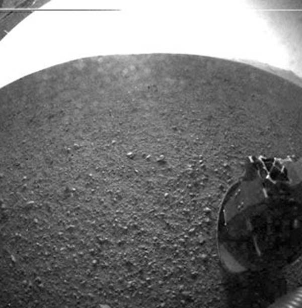 The first two low res b/w images from Curiosity to confirm landing safely |
 |
||||||||||||||||
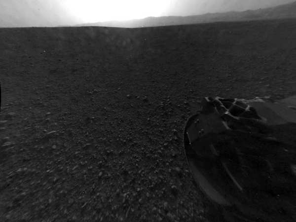 |
 First colour image of Curiosity's surroundings Gale Crater |
||||||||||||||||
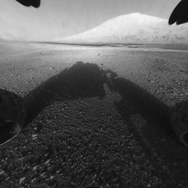 |
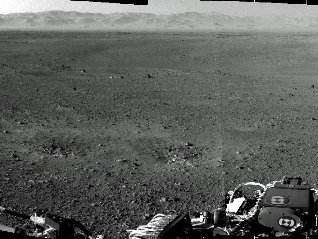
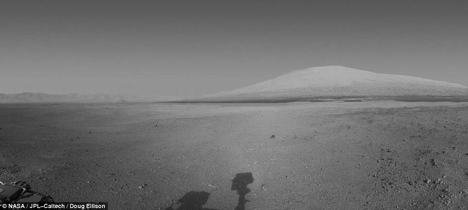
This image shows
one of the first views from NASA's Curiosity rover. The image shows what lies ahead for the rover -- its main science target, Mount Sharp. The rover's shadow can be seen in the foreground, and the dark bands beyond are dunes. Rising up in the distance is the highest peak, Mount Sharp, at a height of about 3.4 miles. |
||||||||||||||||
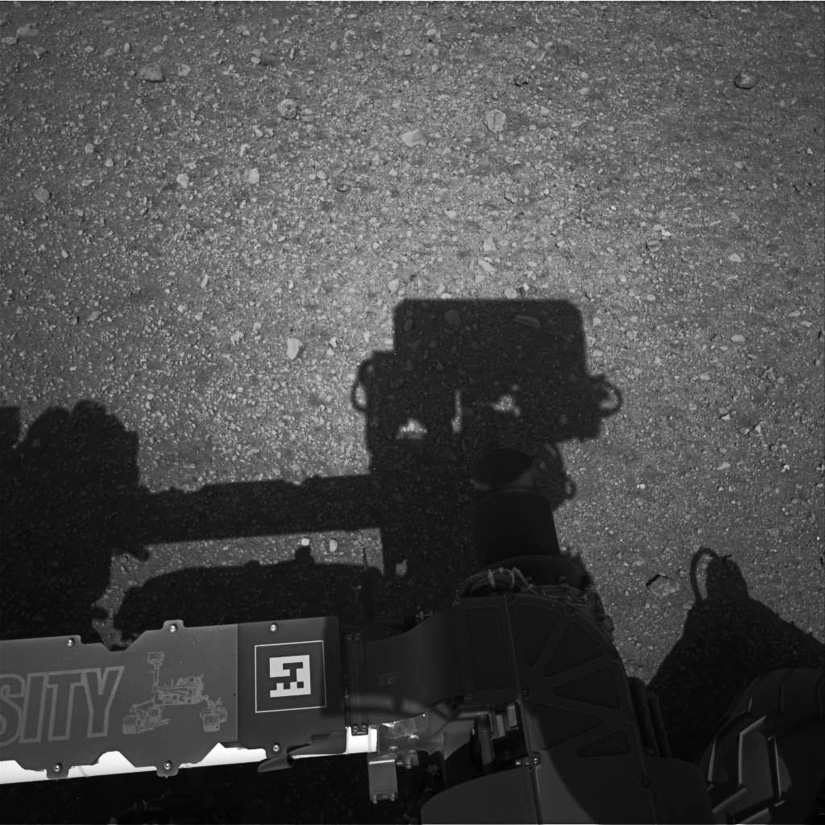 Shadow of the mast |
 Gale Crater |
||||||||||||||||
 Gale Crater rim |
Rocket blast marks on ground |
||||||||||||||||
 |
 Gale Crater & Mount Sharp from Bradbury Landing. |
||||||||||||||||
 Curiosity's tool kit |
 Rock Samples from Drilling |
||||||||||||||||
|
Blast marks, evidence of landing - right |
 22 August 2012, Curiositytook her first drive today on Bradbury Landing, so named after the famous science fiction writer Ray Bradbury who had passed away recently. Part of his writings were The Martian Chronicles, which were made into a tv series. Clearly visible are the remains of the Sky Cranes' rocket engine blasts which lowered Curiosity gently to the surface. |
||||||||||||||||
|
NASA's Curiosity rover mars has begun driving from its landing site, which scientists announced today they have named for the late author Ray Bradbury. Making its first movement on the Martian surface, mars's drive combined forward, turn and reverse segments. This placed the rover roughly 20 feet (6 meters) from the spot where it landed 16 days ago. NASA has approved the Curiosity science team's choice to name the landing ground for the influential author, who was born 92 years ago today and died this year. The location where Curiosity touched down is now called Bradbury Landing. "This was not a difficult choice for the science team," said Michael Meyer, NASA program scientist for mars. "Many of us and millions of other readers were inspired in our lives by stories Ray Bradbury wrote to dream of the possibility of life on Mars." Today's drive confirmed the health of mars's mobility system and produced the rover's first wheel tracks on Mars, documented in images taken after the drive. During a news conference today at NASA's Jet Propulsion Laboratory in Pasadena, Calif., the mission's lead rover driver, Matt Heverly, showed an animation derived from visualization software used for planning the first drive. "We have a fully functioning mobility system with lots of amazing exploration ahead," Heverly said. Curiosity will spend several more days of working beside Bradbury Landing, performing instrument checks and studying the surroundings, before embarking toward its first driving destination approximately 1,300 feet (400 meters) to the east-southeast. "Curiosity is a much more complex vehicle than earlier Mars rovers. The testing and characterization activities during the initial weeks of the mission lay important groundwork for operating our precious national resource with appropriate care," said Curiosity Project Manager Pete Theisinger of JPL. "Sixteen days in, we are making excellent progress." The science team has begun pointing instruments on the rover's mast for investigating specific targets of interest near and far. The Chemistry and Camera (ChemCam) instrument used a laser and spectrometers this week to examine the composition of rocks exposed when the spacecraft's landing engines blew away several inches of overlying material. The instrument's principal investigator, Roger Weins of Los Alamos National Laboratory in New Mexico, reported that measurements made on the rocks in this scoured-out feature called Goulburn suggest a basaltic composition. "These may be pieces of basalt within a sedimentary deposit," Weins said. Curiosity began a two-year prime mission on Mars when the Mars Science Laboratory spacecraft delivered the car-size rover to its landing target inside Gale Crater on Aug. 5 PDT (Aug. 6 EDT). The mission will use 10 science instruments on the rover to assess whether the area has ever offered environmental conditions favorable for microbial life. In a career spanning more than 70 years, Ray Bradbury inspired generations of readers to dream, think and create. A prolific author of hundreds of short stories and nearly 50 books, as well as numerous poems, essays, operas, plays, teleplays and screenplays, Bradbury was one of the most celebrated writers of our time. His groundbreaking works include "Fahrenheit 451," "The Martian Chronicles," "The Illustrated Man," "Dandelion Wine," and "Something Wicked This Way Comes." He wrote the screenplay for John Huston's classic film adaptation of "Moby Dick," and was nominated for an Academy Award. He adapted 65 of his stories for television's The Ray Bradbury Theater, and won an Emmy for his teleplay of "The Halloween Tree." |
|||||||||||||||||
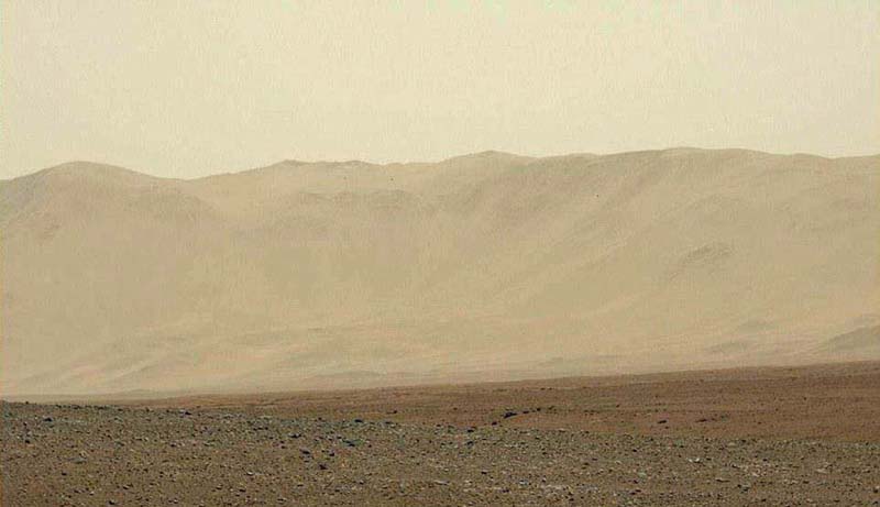
 Base of Mount Sharp, mars's eventual destination |
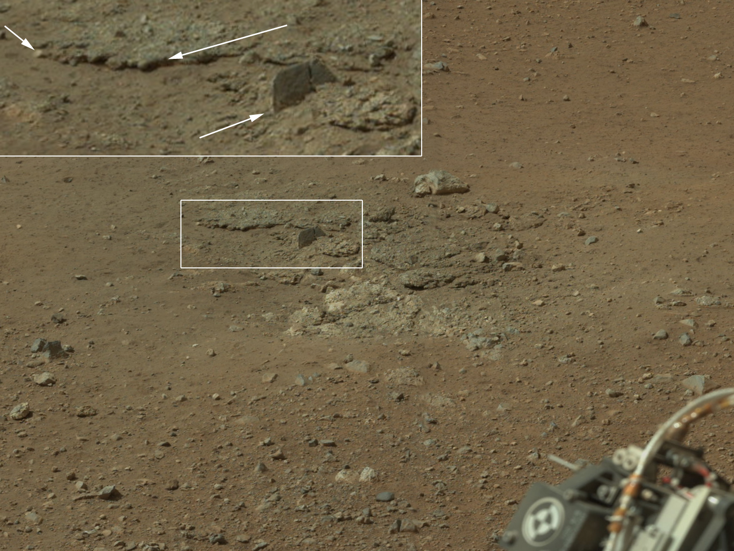
 A rock formation also found on Earth called 'link' |
||||||||||||||||
 NASA's Curiosity Rover found evidence for an ancient flowing stream on Mars, at a few sites, including the rocky outcrop pictured here. which the scence team has named 'Hottah' after hottah Lake in Canada's Northwest Territories. This image mosaic was taken by Curiosity's 100 milimeter Mastcam lens on its 39th Martian day. |
 |
||||||||||||||||
 Area known as rocknest above and several shots below |
 |
||||||||||||||||
 |
 |
||||||||||||||||
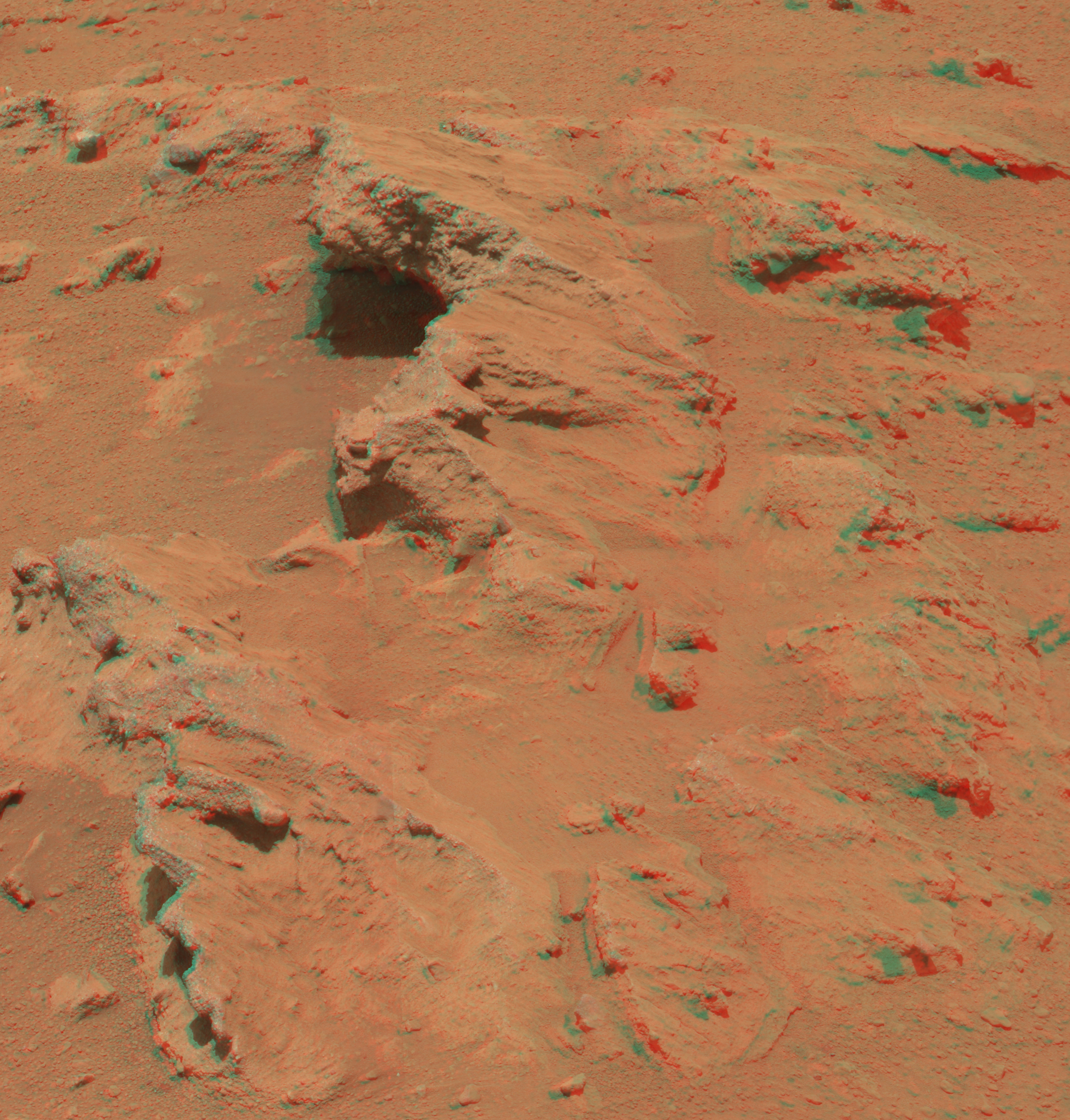 Use 3d glasses on this |
 |
||||||||||||||||
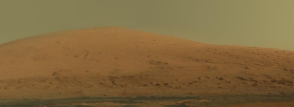 |
Mount Sharp as it would appear naturally, using the equivalent of a mobile phone camera, and below (left) a 'white enhanced image giving a false colour to the sky but greater detail of the mountain | ||||||||||||||||
 |
Rising above the present location of NASA's
Curiosity rover, higher than any mountain in the 48 contiguous
states of the United States, Mount Sharp is featured in new imagery from
the rover. A pair of mosaics assembled from dozens of telephoto images
shows Mount Sharp in dramatic detail. The component images were taken by
the 100-millimeter-focal-length telephoto lens camera mounted on the
right side of mars's remote sensing mast, during the 45th Martian
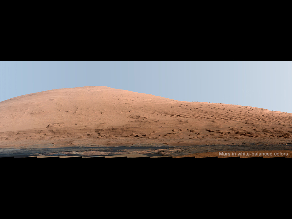
day of the rover's mission on Mars (Sept. 20, 2012). This layered mound, also called Aeolis Mons, in the center of Gale Crater rises more than 3 miles (5 kilometers) above the crater floor location of mars. Lower slopes of Mount Sharp remain a destination for the mission, though the rover will first spend many more weeks around a location called "Yellowknife Bay," where it has found evidence of a past environment favorable for microbial life. A version of the mosaic that has been white-balanced to show the terrain as if under Earth like lighting, which makes the sky look overly blue, is at http://photojournal.jpl.nasa.gov/catalog/PIA16768 |
||||||||||||||||
|
White-balanced
versions help scientists recognize rock materials based on their
terrestrial experience. The Martian sky would look like more of a
butterscotch color to the human eye. A version of the mosaic with raw
color, as a typical smart-phone camera would show the scene, is at
http://photojournal.jpl.nasa.gov/catalog/PIA16769 The white-balanced and raw images are both available with pan and zoom functionality on GigaPan at http://www.gigapan.com/gigapans/125627 and http://www.gigapan.com/gigapans/125628, respectively. In both versions, the sky has been filled out by extrapolating color and brightness information from the portions of the sky that were captured in images of the terrain. NASA's Mars Science Laboratory project is using Curiosity and the rover's 10 science instruments to investigate environmental history within Gale Crater, a location where the project has found that conditions were long ago favorable for microbial life. Malin Space Science Systems, San Diego, built and operates the Mast Camera (Mastcam) instrument. NASA's Jet Propulsion Laboratory, a division of the California Institute of Technology in Pasadena, manages the Mars Science Laboratory mission for the NASA Science Mission Directorate, Washington, and built the rover. For more information about the mission, visit http://www.nasa.gov/msl and http://mars.jpl.nasa.gov/msl Follow the mission on Facebook at - http://www.facebook.com/mars and on Twitter at - http://www.twitter.com/mars |
 |
||||||||||||||||
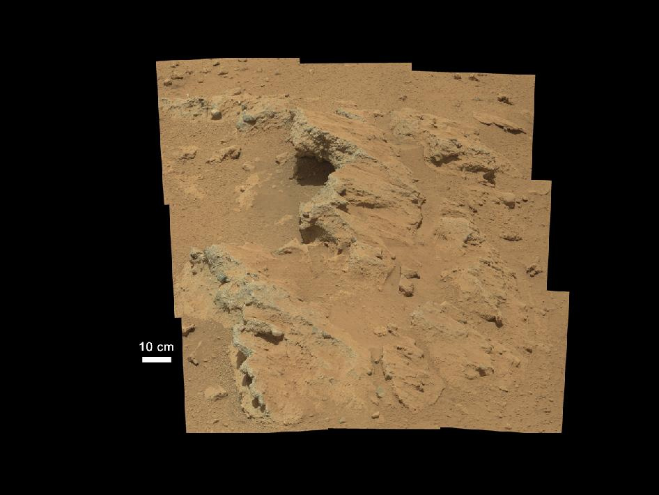
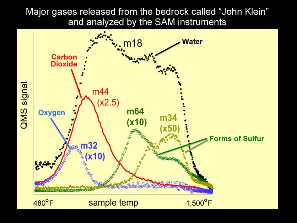
|
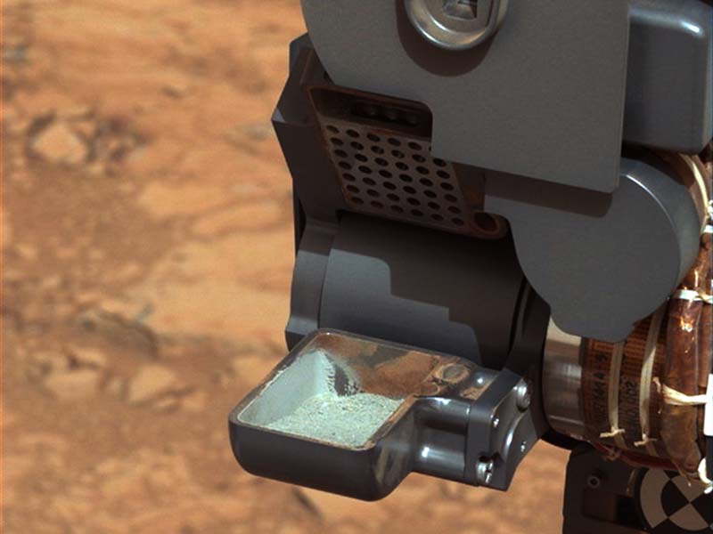
This image from NASA's
Curiosityrover shows the first sample of powdered rock extracted by the
rover's drill. The image was taken after the sample was transferred from
the drill to the rover's scoop. In planned subsequent steps, the sample
will be was sieved, and portions of it delivered to the Chemistry and
Mineralogy instrument and the Sample Analysis at Curiosityinstrument.
The
scoop is 1.8 inches (4.5 centimeters) wide. The image was obtained by mars's Mast Camera on Feb. 20 2013, or Sol 193, mars's 193rd Martian day of operations. The image has been white-balanced to show what the sample would look like if it were on Earth. The gray-green powder seen in the white-balanced
version is from the rock called "John Klein." Red residue clinging to
the scoop walls is from a sample collected earlier from a drift of
windblown dust and sand called "Rocknest." The differing colors between
the residue from Rocknest and the drill powder from John Klein reflect
the oxidation state of iron in the samples. The John Klein powder is
less oxidized and therefore has a higher potential to preserve organic
compounds, if they were originally present. Image credit: NASA/JPL-Caltech/MSSS |
 |
||||||||||||||||
 En Route to Mt Sharp, see update below - July 2013 |
 Summer 2014 and Curiosity arrives at the foothills of Mount Sharp. |
||||||||||||||||
|
NASA's Mars Science Laboratory rover Curiosity appears as a bluish dot near the lower right corner of this enhanced-color view from the High Resolution Imaging Science Experiment (HiRISE) camera on NASA's Mars Reconnaissance Orbiter. The rover's tracks are visible extending from the landing site, "Bradbury Landing," in the left half of the scene. Two bright, relatively blue spots surrounded by darker patches are where the Mars Science Laboratory spacecraft's landing jets cleared away reddish surface dust at the landing site. North is toward the top. For scale, the two parallel lines of the wheel tracks are about 10 feet (3 meters) apart. HiRISE shot this image on June 27, 2013, when Curiosity was at an outcrop called "Shaler" in the "Glenelg" area of Gale Crater. Subsequently the rover drove away from Glenelg toward the southwest. When HiRISE captured this view, the Mars Reconnaissance Orbiter was rolled for an eastward-looking angle rather than straight downward. The afternoon sun illuminated the scene from the western sky, so the lighting was nearly behind the camera. Specifically, the angle from sun to orbiter to rover was just 5.47 degrees. This geometry hides shadows and reveals subtle color variations. The image is one product from HiRISE observation ESP_032436_1755. Other image products from this observation are available at http://www.uahirise.org/ESP_032436_1755 . HiRISE is one of six instruments on NASA's Mars Reconnaissance Orbiter. The University of Arizona, Tucson, operates HiRISE, which was built by Ball Aerospace & Technologies Corp., Boulder, Colo. NASA's Jet Propulsion Laboratory, a division of the California Institute of Technology in Pasadena, manages the Mars Reconnaissance Orbiter and Mars Science Laboratory projects for NASA's Science Mission Directorate, Washington. Image credit: NASA/JPL-Caltech/Univ. of Arizona |
|||||||||||||||||
| July 2013 Update NASA's Mars rover Curiosity drove twice as far on July 21 as on any other day of the mission so far: 109.7 yards (100.3 meters). The length of the drive took advantage of starting the 340th Martian day, or sol, of the mission from a location with an unusually good view for rover engineers to plan a safe path. In weeks to come, the rover team plans to begin using "autonav" capability for the rover to autonomously navigate a path for itself, which could make such long drives more frequent. Curiosity is about three weeks into a multi-month trek, from the "Glenelg" area where it worked for the first half of 2013, to an entry point for the mission's major destination: the lower layers of Mount Sharp. The mission's longest one-day drive prior to July 21 was about 54 yards (49 meters), on Sol 50 (Sept. 26, 2012). After completing the longer drive, Curiositydrove 68.2 yards (62.4 meters) on July 23 (Sol 342), bringing the mission's total driving distance so far to 0.81 mile (1.23 kilometers). he Sol 340 drive included three segments, with turns at the end of the first and second segments. Rover planners used information from stereo imaging by the Navigation Camera (Navcam) on mars's mast, plus images from the telephoto-lens Mast Camera (Mastcam). The drive also used the rover's capability to use imagery taken during the drive to calculate the driving distance, a way to verify that wheels have not been slipping too much while turning. "What enabled us to drive so far on Sol 340 was starting at a high point and also having Mastcam images giving us the size of rocks so we could be sure they were not hazards," said rover planner Paolo Bellutta of NASA's Jet Propulsion Laboratory, Pasadena, Calif. “We could see for quite a distance, but there was an area straight ahead that was not clearly visible, so we had to find a path around that area." The rover was facing southwest when the sol began. It turned slightly more to the west before driving and used visual odometry to be sure it drove the intended distance (about 55 yards or 50 meters) before turning back farther southward. The second leg, next turn, and third leg completed the drive without visual odometry, though the rover was using another new capability: to turn on visual odometry autonomously if tilt or other factors exceed predetermined limits. New software on Curiositygives it the capability to use visual odometry through a range of temperatures. This was needed because testing this spring indicated the Navcam pair linked to the rover's B-side computer is more sensitive to temperature than anticipated. Without the compensating software, the onboard analysis of stereo images could indicate different distances to the same point, depending on the temperature at which the images are taken. The rover was switched from its A-side computer to the redundant B-side computer on Feb. 28 due to a flash-memory problem -- subsequently resolved -- on the A-side. The Navcam pair linked to the A-side computer shows less variability with temperature than the pair now in use. "For now, we're using visual odometry mostly for slip-checking," said JPL's Jennifer Trosper, deputy project manager for mars. "We are validating the capability to begin using autonav at different temperatures." The autonomous navigation capability will enable rover planners to command drives that go beyond the route that they can confirm as safe from previous-sol images. They can tell the rover to use the autonomous capability to choose a safe path for itself beyond that distance. Curiosity landed at the "Bradbury Landing" location within Gale Crater on Aug. 6, 2012, EDT and Universal Time (Aug. 5, PDT). From there, the rover drove eastward to the Glenelg area, where it accomplished the mission's major science objective of finding evidence for an ancient wet environment that had conditions favorable for microbial life. The rover's route is now southwestward. At Mount Sharp, in the middle of Gale Crater, scientists anticipate finding evidence about how the ancient Martian environment changed and evolved. JPL, a division of the California Institute of Technology, Pasadena, manages the Mars Science Laboratory Project for NASA's Science Mission Directorate, Washington. JPL designed and built the project's Curiosityrover. More information about Curiosity is online at http://www.nasa.gov/msl and http://mars.jpl.nasa.gov/msl/ . You can follow the mission on Facebook at http://www.facebook.com/marsmars and on Twitter at http://www.twitter.com/marsmars http://www.space.com/27277-mars-drills-into-martian-mountain-for-first-time-video.html |
|||||||||||||||||
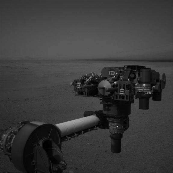
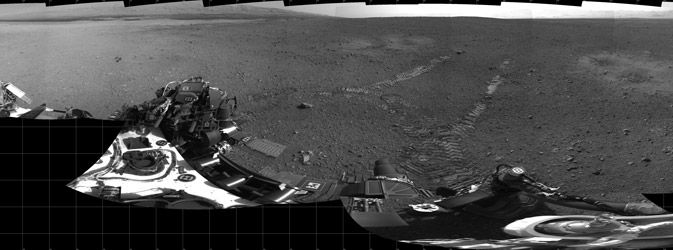
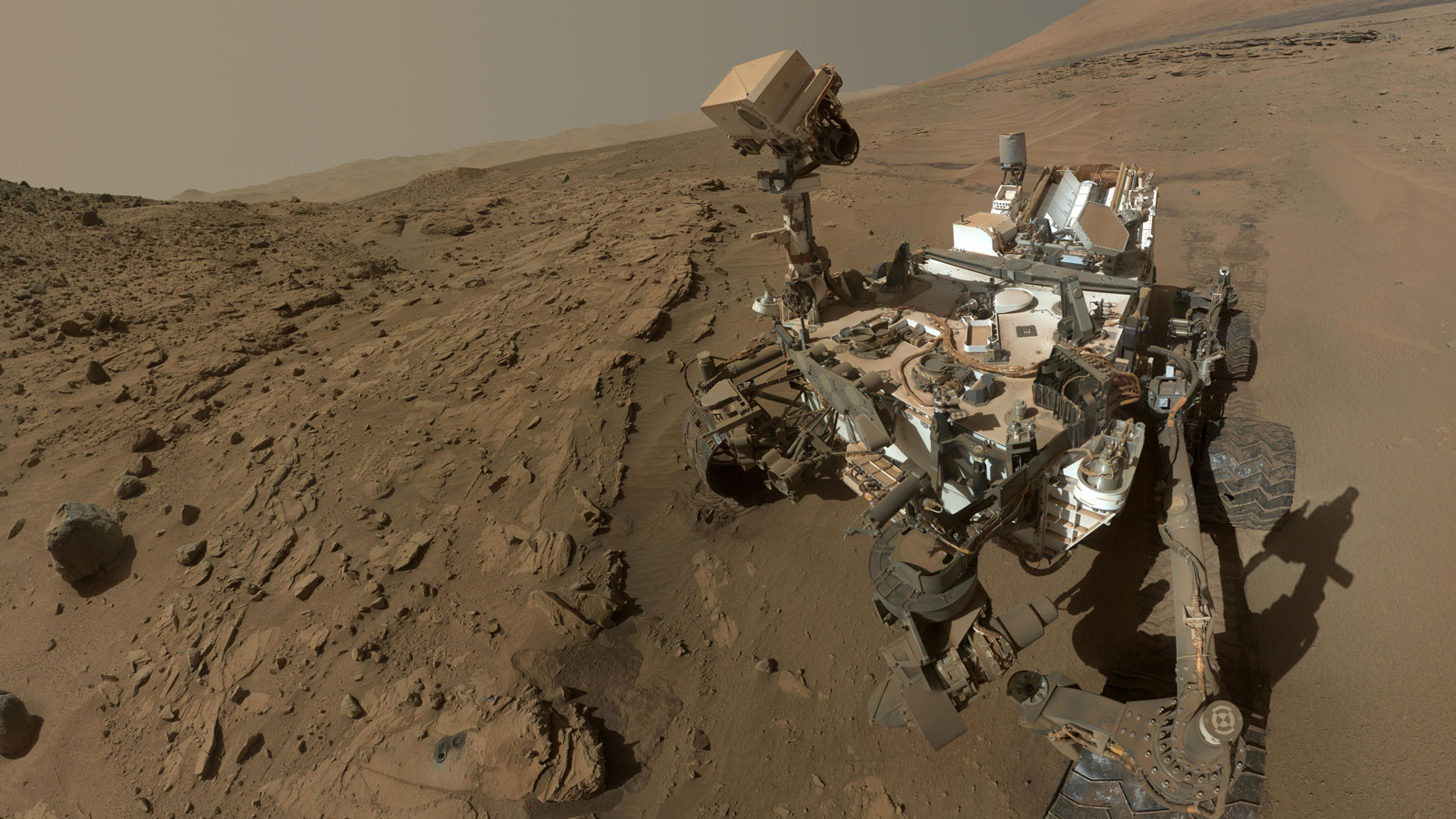 Self portrait so that the contollers can see the state of the rover |
 |
||||||||||||||||
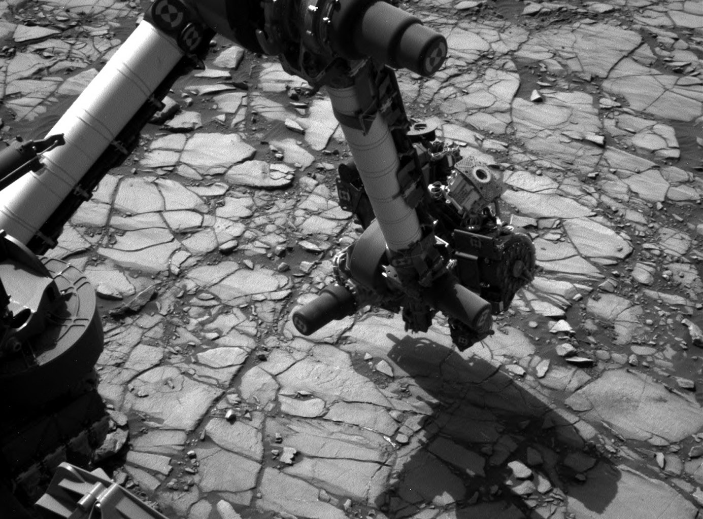
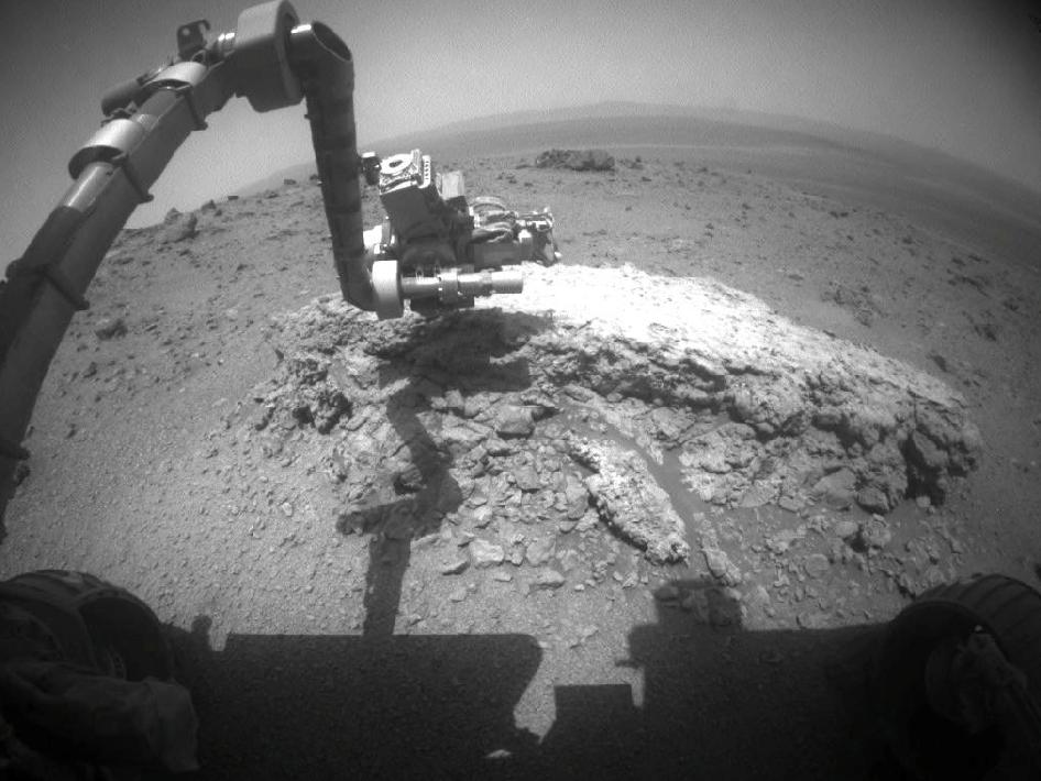 Curiosity examines rock |
|
||||||||||||||||
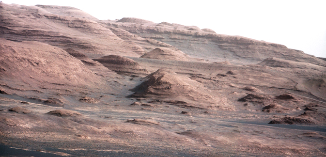
 |
Curiosity, the big rover of NASA's
Mars Science Laboratory mission, landed in August 2012 near the
foot of a mountain inside Gale Crater. (circled area). The
mission's project science group is calling the mountain Mount
Sharp. This informal naming pays tribute to geologist Robert P.
Sharp (1911-2004), a founder of planetary science, influential
teacher of many current leaders in the field, and team member for
NASA's early Mars missions. This oblique view of Mount
Sharp, is derived from a combination of elevation and imaging data
from three Mars orbiters. The view is looking toward the
southeast. Gale Crater is 96 miles (154 kilometers) in diameter.
Stratification on Mount Sharp suggests the mountain is a surviving
remnant of an extensive series of deposits that were laid down
after a massive impact that excavated Gale Crater more than 3
billion years ago. The layers offer a history book of sequential
chapters recording environmental conditions when each stratum was
deposited. http://www.nasa.gov/mission_pages/msl/multimedia/pia15292.html |
||||||||||||||||
 Human rubbish on Mars |
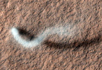 Dust Devil on Martian Surface |
||||||||||||||||
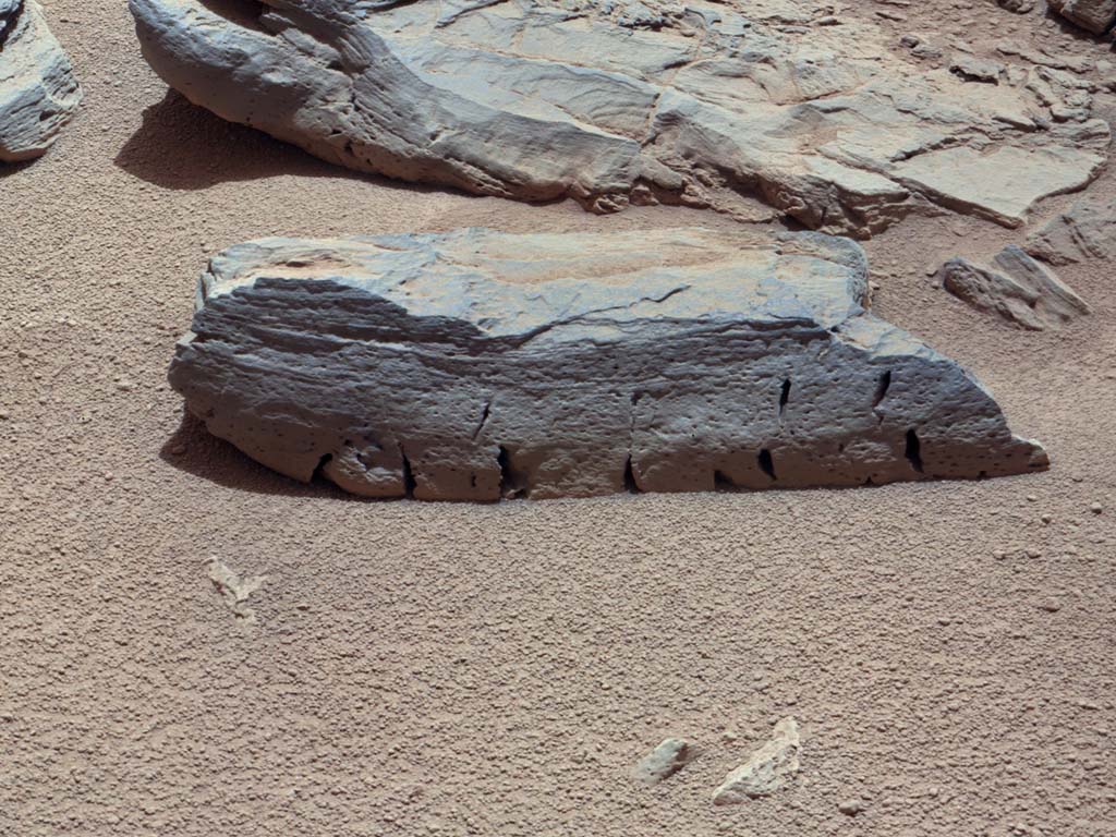
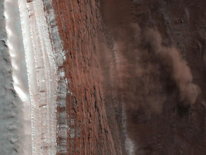
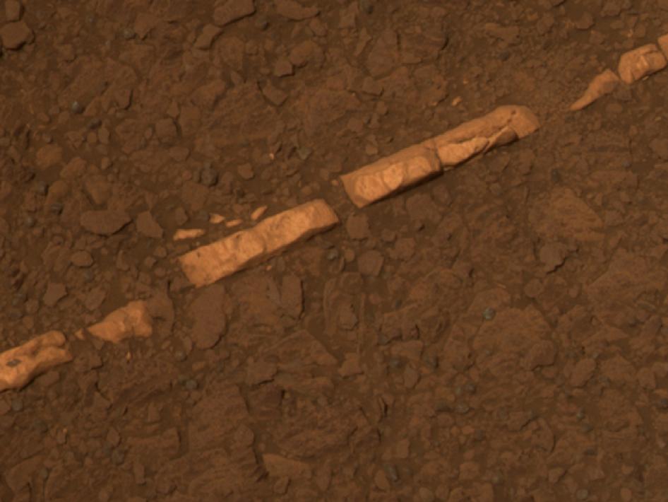 Mineral vein |
 Dust storms sweep across the northern hemisphere - Sept 2014 |
||||||||||||||||
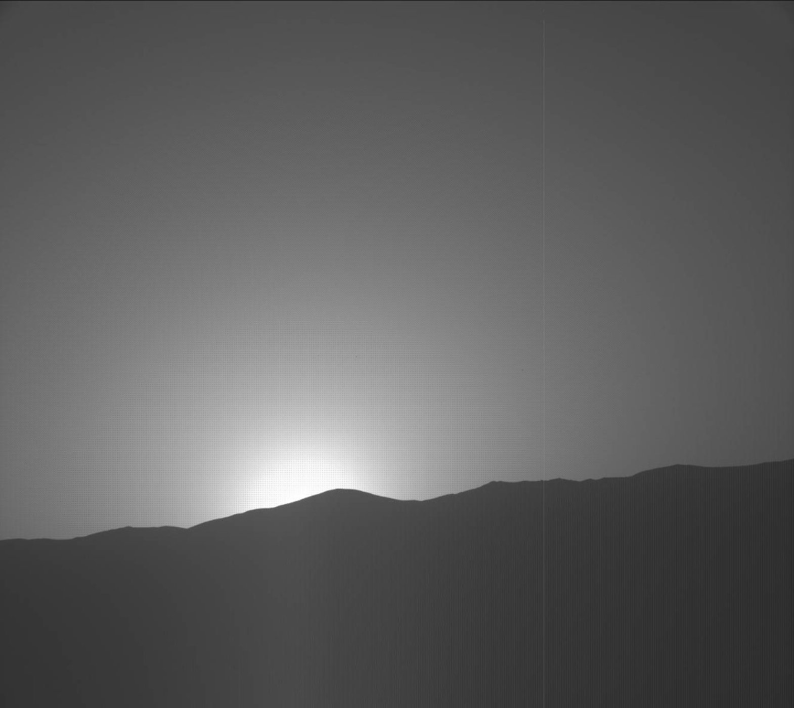
 Daybreak at Gale Crater |
 |
||||||||||||||||
|
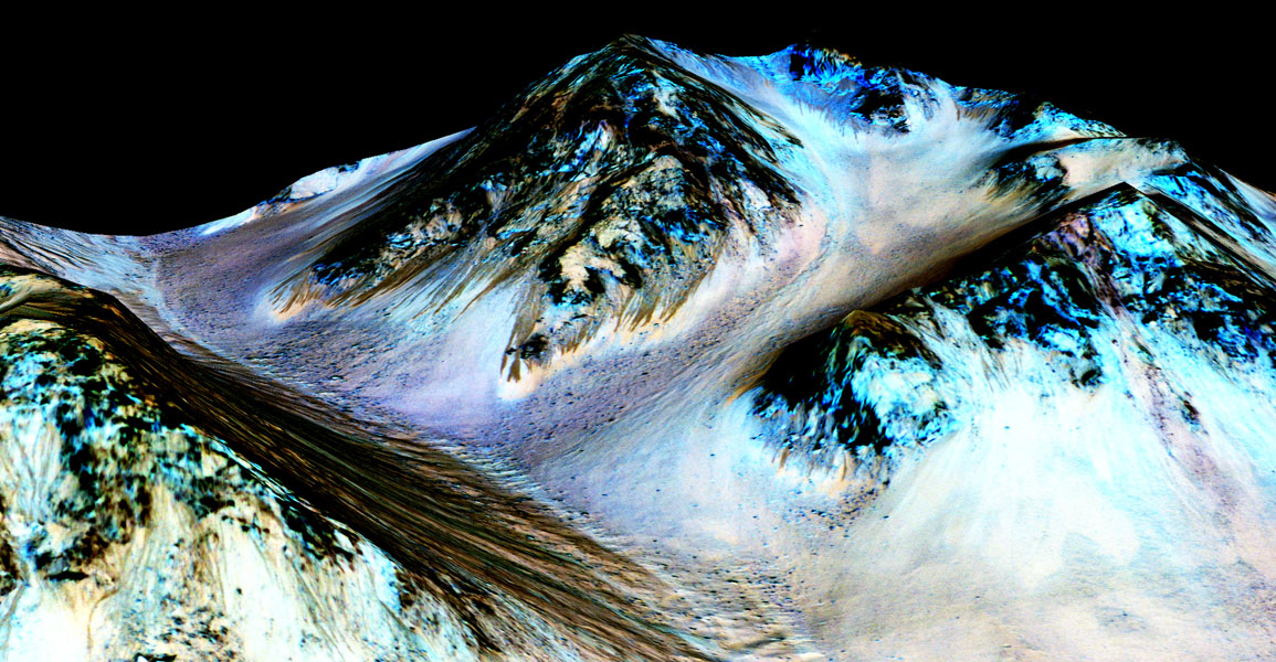
September 2015: New findings from NASA's Mars Reconnaissance Orbiter (MRO) provide the strongest evidence yet that liquid water flows intermittently on present-day Mars. Using an imaging spectrometer on MRO, researchers detected signatures of hydrated minerals on slopes where mysterious streaks are seen on the Red Planet. These darkish streaks appear to ebb and flow over time. They darken and appear to flow down steep slopes during warm seasons, and then fade in cooler seasons. They appear in several locations on Mars when temperatures are above minus 10 degrees Fahrenheit (minus 23 Celsius), and disappear at colder times. "Our quest on Mars has been to 'follow the water,' in our search for life in the universe, and now we have convincing science that validates what we've long suspected," said John Grunsfeld, astronaut and associate administrator of NASA's Science Mission Directorate in Washington. "This is a significant development, as it appears to confirm that water -- albeit briny -- is flowing today on the surface of Mars." These downhill flows, known as recurring slope lineae (RSL), often have been described as possibly related to liquid water. The new findings of hydrated salts on the slopes point to what that relationship may be to these dark features. The hydrated salts would lower the freezing point of a liquid brine, just as salt on roads here on Earth causes ice and snow to melt more rapidly. Scientists say it's likely a shallow subsurface flow, with enough water wicking to the surface to explain the darkening. "We found the hydrated salts only when the seasonal features were widest, which suggests that either the dark streaks themselves or a process that forms them is the source of the hydration. In either case, the detection of hydrated salts on these slopes means that water plays a vital role in the formation of these streaks," said Lujendra Ojha of the Georgia Institute of Technology (Georgia Tech) in Atlanta, lead author of a report on these findings published Sept. 28 by Nature Geoscience. Ojha first noticed these puzzling features as a University of Arizona undergraduate student in 2010, using images from the MRO's High Resolution Imaging Science Experiment (HiRISE). HiRISE observations now have documented RSL at dozens of sites on Mars. The new study pairs HiRISE observations with mineral mapping by MRO's Compact Reconnaissance Imaging Spectrometer for Mars (CRISM). The spectrometer observations show signatures of hydrated salts at multiple RSL locations, but only when the dark features were relatively wide. When the researchers looked at the same locations and RSL weren't as extensive, they detected no hydrated salt. Ojha and his co-authors interpret the spectral signatures as caused by hydrated minerals called perchlorates. The hydrated salts most consistent with the chemical signatures are likely a mixture of magnesium perchlorate, magnesium chlorate and sodium perchlorate. Some perchlorates have been shown to keep liquids from freezing even when conditions are as cold as minus 94 degrees Fahrenheit (minus 70 Celsius). On Earth, naturally produced perchlorates are concentrated in deserts, and some types of perchlorates can be used as rocket propellant. Perchlorates have previously been seen on Mars. NASA's Phoenix lander and Curiosity rover both found them in the planet's soil, and some scientists believe that the Viking missions in the 1970s measured signatures of these salts. However, this study of RSL detected perchlorates, now in hydrated form, in different areas than those explored by the landers. This also is the first time perchlorates have been identified from orbit. MRO has been examining Mars since 2006 with its six science instruments. "The ability of MRO to observe for multiple Mars years with a payload able to see the fine detail of these features has enabled findings such as these: first identifying the puzzling seasonal streaks and now making a big step towards explaining what they are," said Rich Zurek, MRO project scientist at NASA's Jet Propulsion Laboratory in Pasadena, California. For Ojha, the new findings are more proof that the mysterious lines he first saw darkening Martian slopes five years ago are, indeed, present-day water. "When most people talk about water on Mars, they're usually talking about ancient water or frozen water," he said. "Now we know there's more to the story. This is the first spectral detection that unambiguously supports our liquid water-formation hypotheses for RSL." The discovery is the latest of many breakthroughs by NASA's Mars missions. "It took multiple spacecraft over several years to solve this mystery, and now we know there is liquid water on the surface of this cold, desert planet," said Michael Meyer, lead scientist for NASA's Mars Exploration Program at the agency's headquarters in Washington. "It seems that the more we study Mars, the more we learn how life could be supported and where there are resources to support life in the future." There are eight co-authors of the Nature Geoscience paper, including Mary Beth Wilhelm at NASA's Ames Research Center in Moffett Field, California and Georgia Tech; CRISM Principal Investigator Scott Murchie of the Johns Hopkins University Applied Physics Laboratory in Laurel, Maryland; and HiRISE Principal Investigator Alfred McEwen of the University of Arizona Lunar and Planetary Laboratory in Tucson, Arizona. Others are at Georgia Tech, the Southwest Research Institute in Boulder, Colorado, and Laboratoire de Plan?tologie et G?odynamique in Nantes, France. The agency's Jet Propulsion Laboratory in Pasadena, California, a division of the California Institute of Technology, manages the Mars Reconnaissance Orbiter Project for NASA's Science Mission Directorate, Washington. Lockheed Martin built the orbiter and collaborates with JPL to operate it.
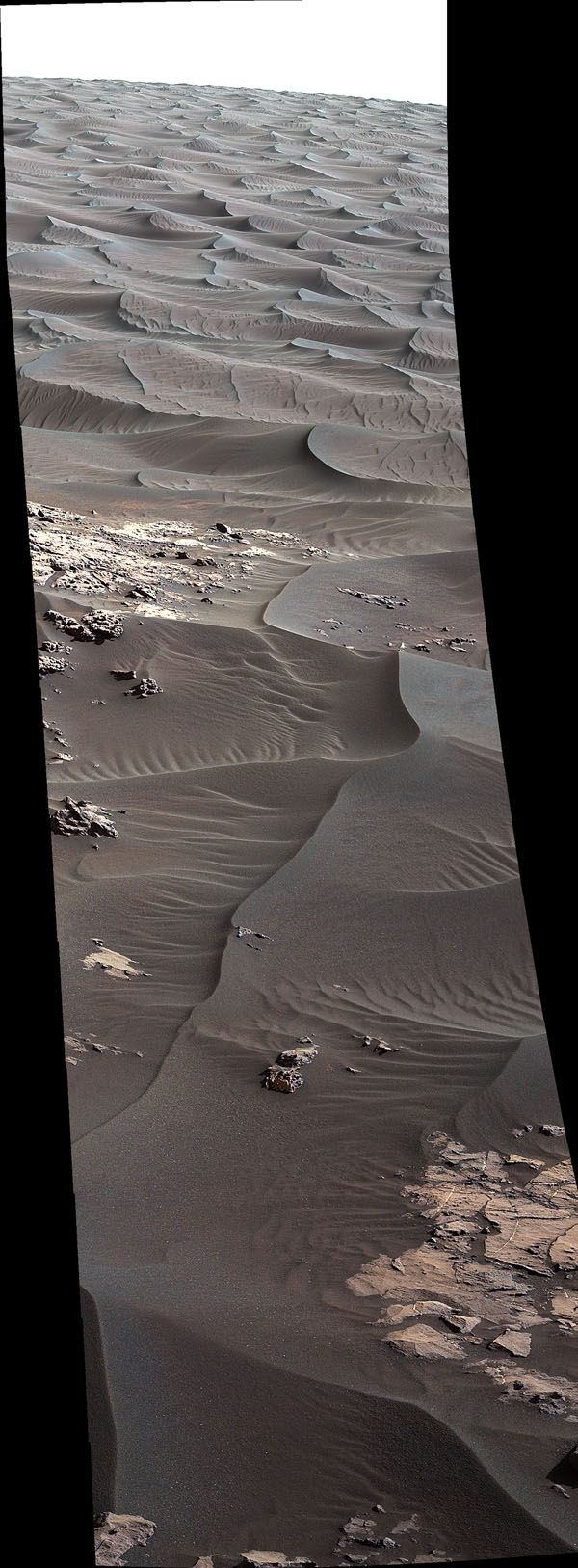
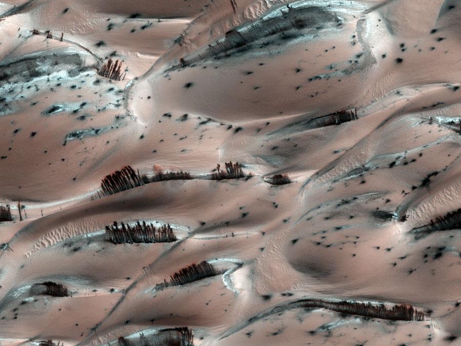
right: sand dunes
|
 |
||||||||||||||||
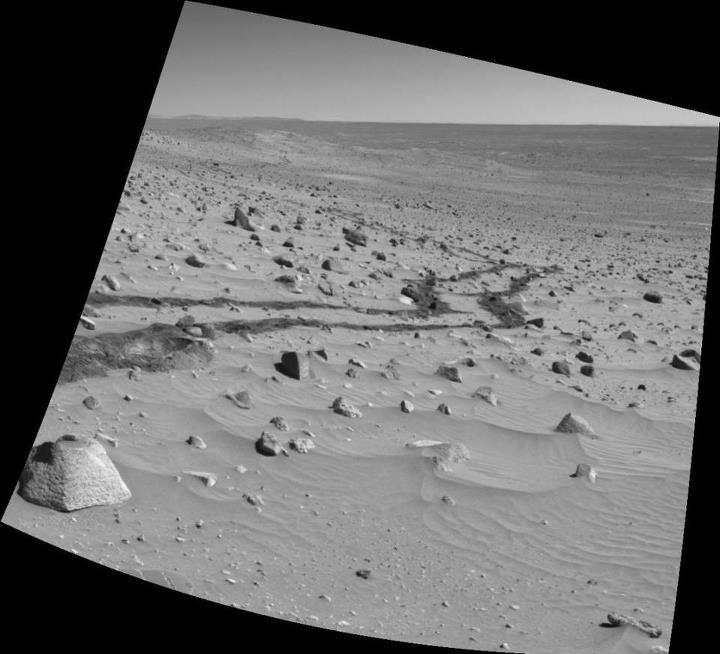
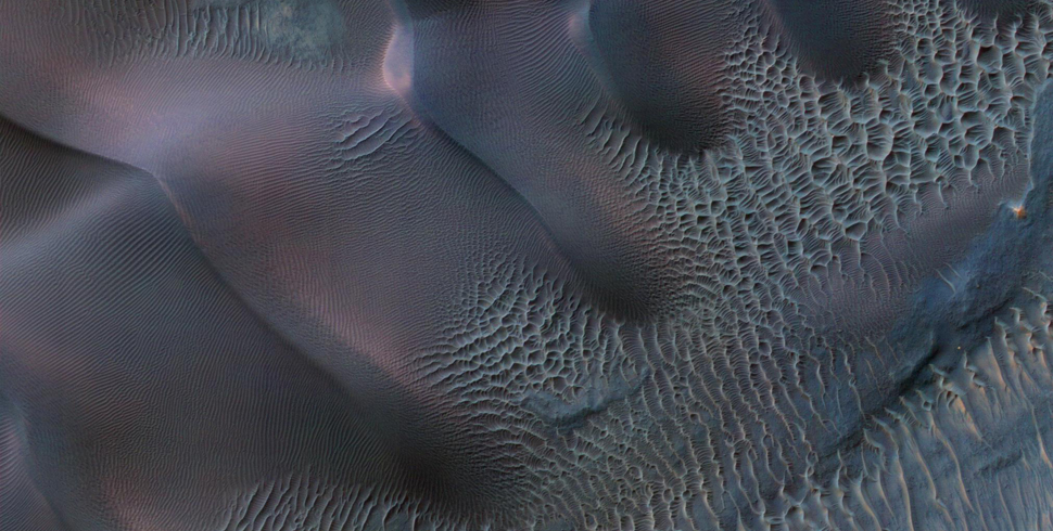 Martian Sand dunes |
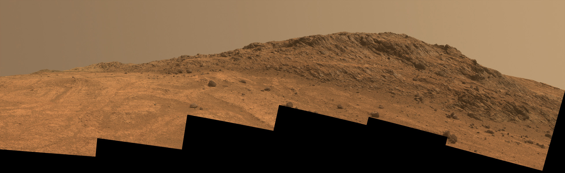 Hinners Point (Opportunity image) |
||||||||||||||||
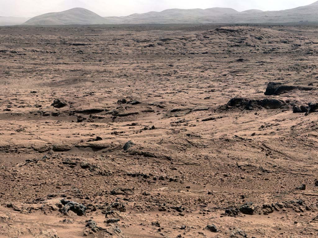
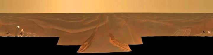 Martian Plains |
|
||||||||||||||||
|
|
 Storm on the surface of Mars |
||||||||||||||||
 Yes! Its Mars and no, not trees! |
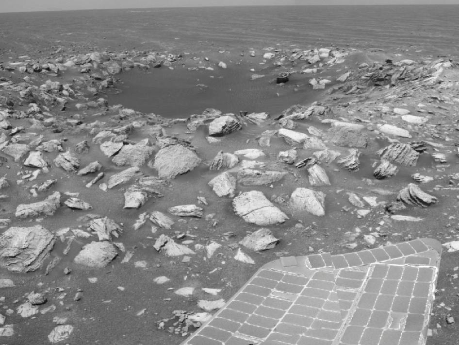 Martian Crater (Opportunity solar panel visible) |
||||||||||||||||
Amazing images at Mount Sharp from Curiosity - Sept 2016 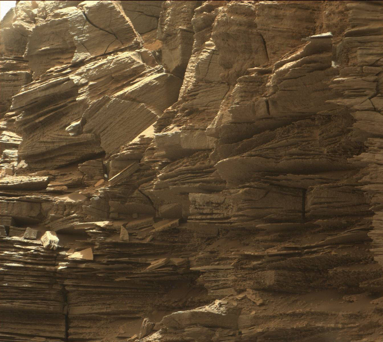 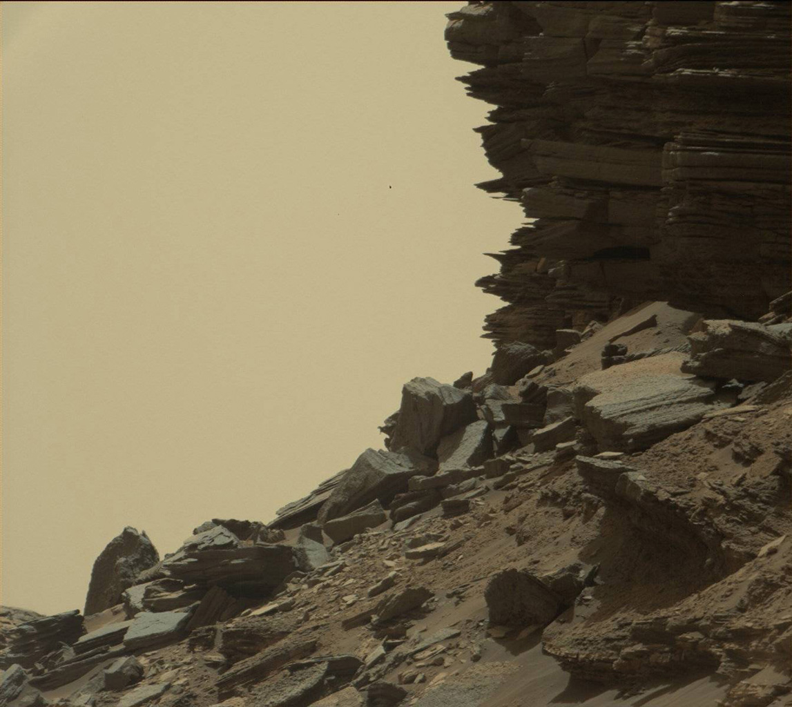 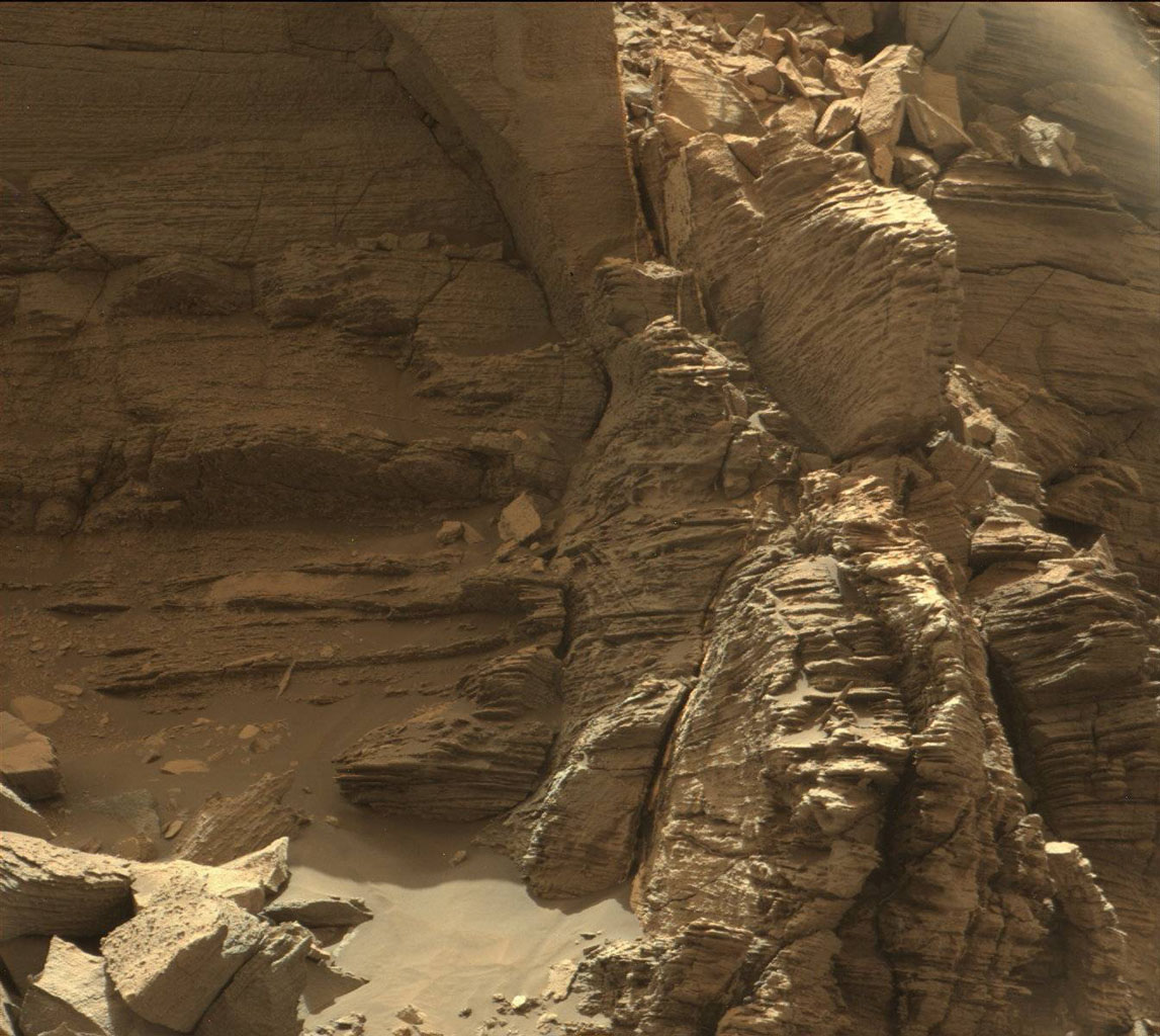 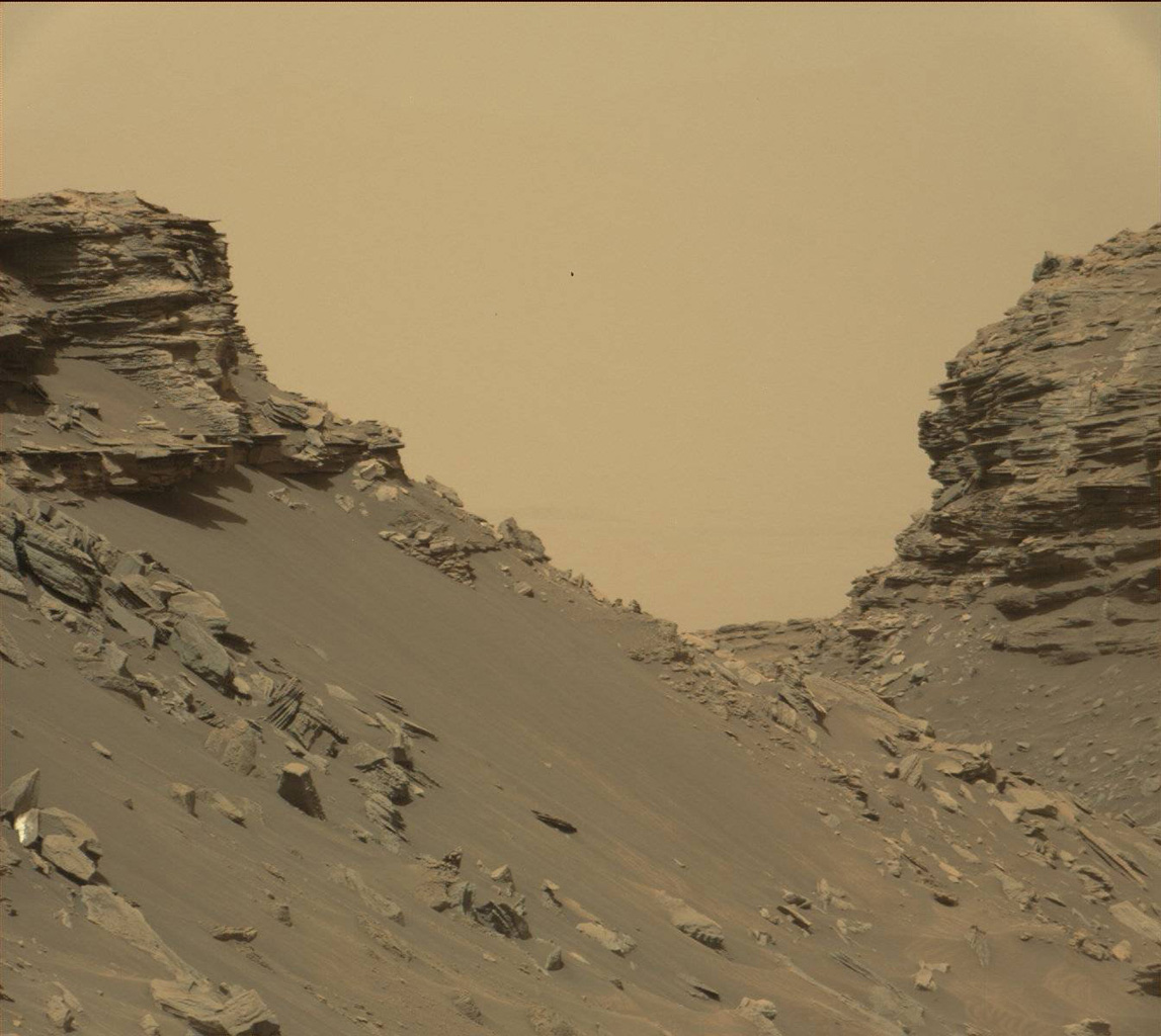 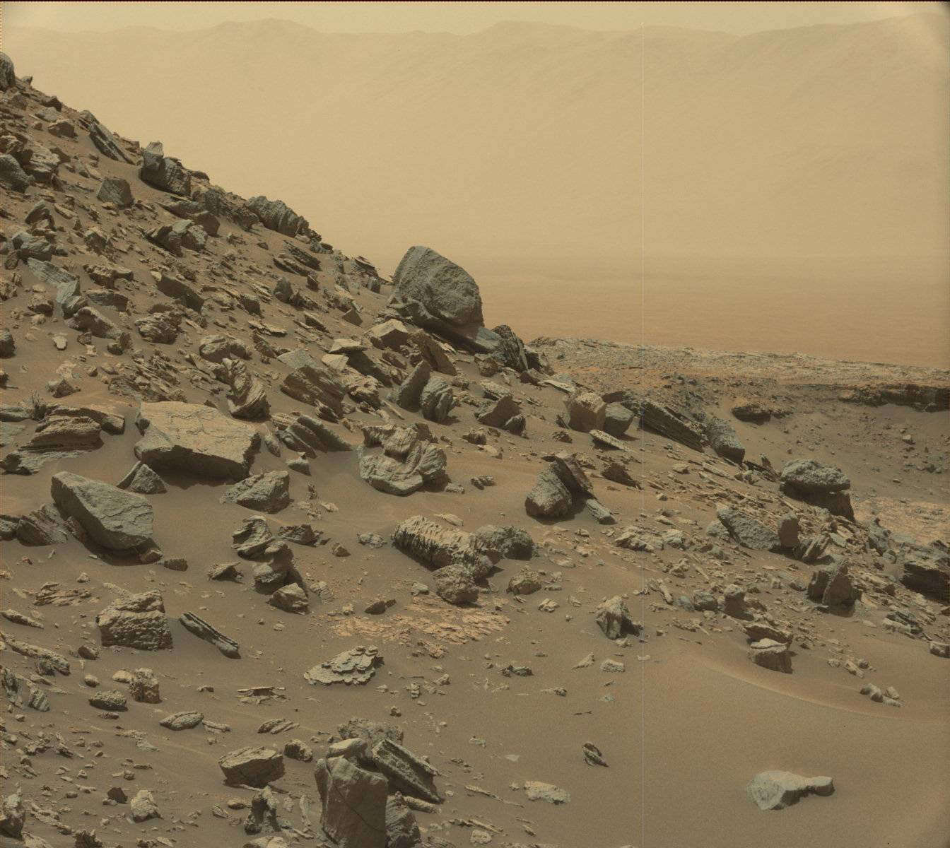 |
|||||||||||||||||
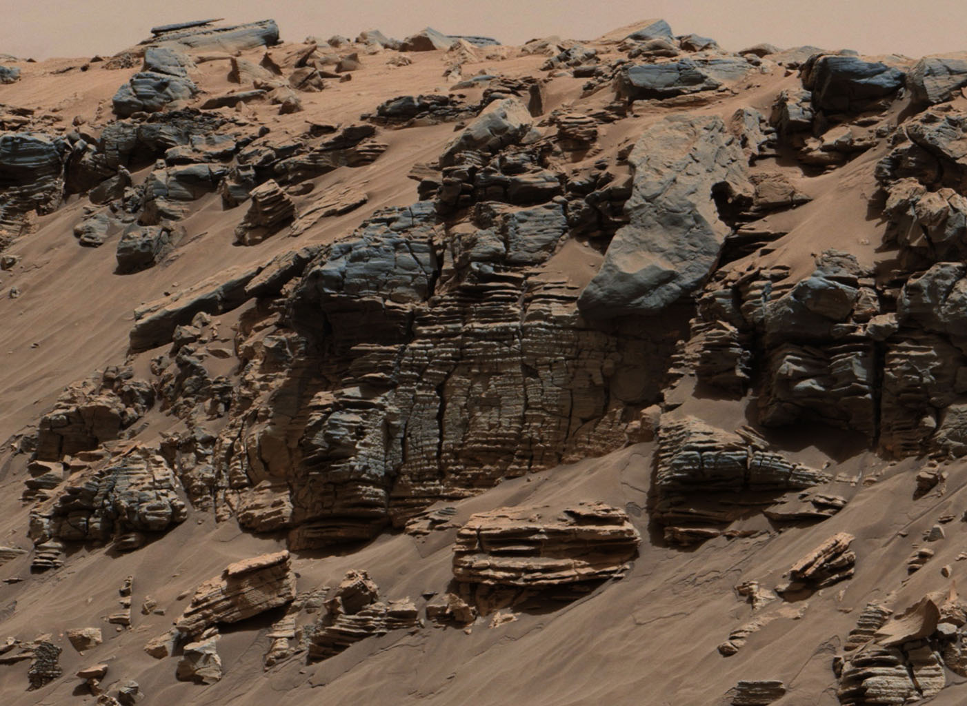
| The layered geologic past of Mars
is revealed in stunning detail in new color images returned by NASA's
Curiosity Mars rover, which is currently exploring the "Murray Buttes"
region of lower Mount Sharp. The new images arguably rival photos taken
in U.S. National Parks. Curiosity took the images with its Mast Camera
(Mastcam) on Sept. 8. The rover team plans to assemble several large,
color mosaics from the multitude of images taken at this location in the
near future. "mars's science team has been just thrilled to go on
this road trip through a bit of the American desert Southwest on Mars,"
said Curiosity Project Scientist Ashwin Vasavada, of NASA's Jet
Propulsion Laboratory, Pasadena, California. The Martian buttes and mesas rising above the surface are eroded remnants of ancient sandstone that originated when winds deposited sand after lower Mount Sharp had formed. "Studying these buttes up close has given us a better understanding of ancient sand dunes that formed and were buried, chemically changed by groundwater, exhumed and eroded to form the landscape that we see today," Vasavada said. The new images represent mars's last stop in the Murray Buttes, where the rover has been driving for just over one month. As of this week, Curiosity has exited these buttes toward the south, driving up to the base of the final butte on its way out. In this location, the rover began its latest drilling campaign (on Sept. 9). After this drilling is completed, Curiosity will continue farther south and higher up Mount Sharp, leaving behind these spectacular formations. Curiosity landed near Mount Sharp in 2012. It reached the base of the mountain in 2014 after successfully finding evidence on the surrounding plains that ancient Martian lakes offered conditions that would have been favorable for microbes if Mars has ever hosted life. Rock layers forming the base of Mount Sharp accumulated as sediment within ancient lakes billions of years ago. On Mount Sharp, Curiosity is investigating how and when the habitable ancient conditions known from the mission's earlier findings evolved into conditions drier and less favorable for life. For more information about mars, visit: http://mars.jpl.nasa.gov/msl |
|||||||||||||||||
 August 2016 |
|||||||||||||||||
 Sunset November 2017 |
|||||||||||||||||
| Its now February 2018 and curiosity
is still going strong, but with some wear and tear on its wheels.
This image is a composite of many images taken by curiosities
mast camera and shows it on the slopes of Mount Sharp. The pinnacle of
Mount Sharp can be seen upper right. This was taken on 23 January 2018 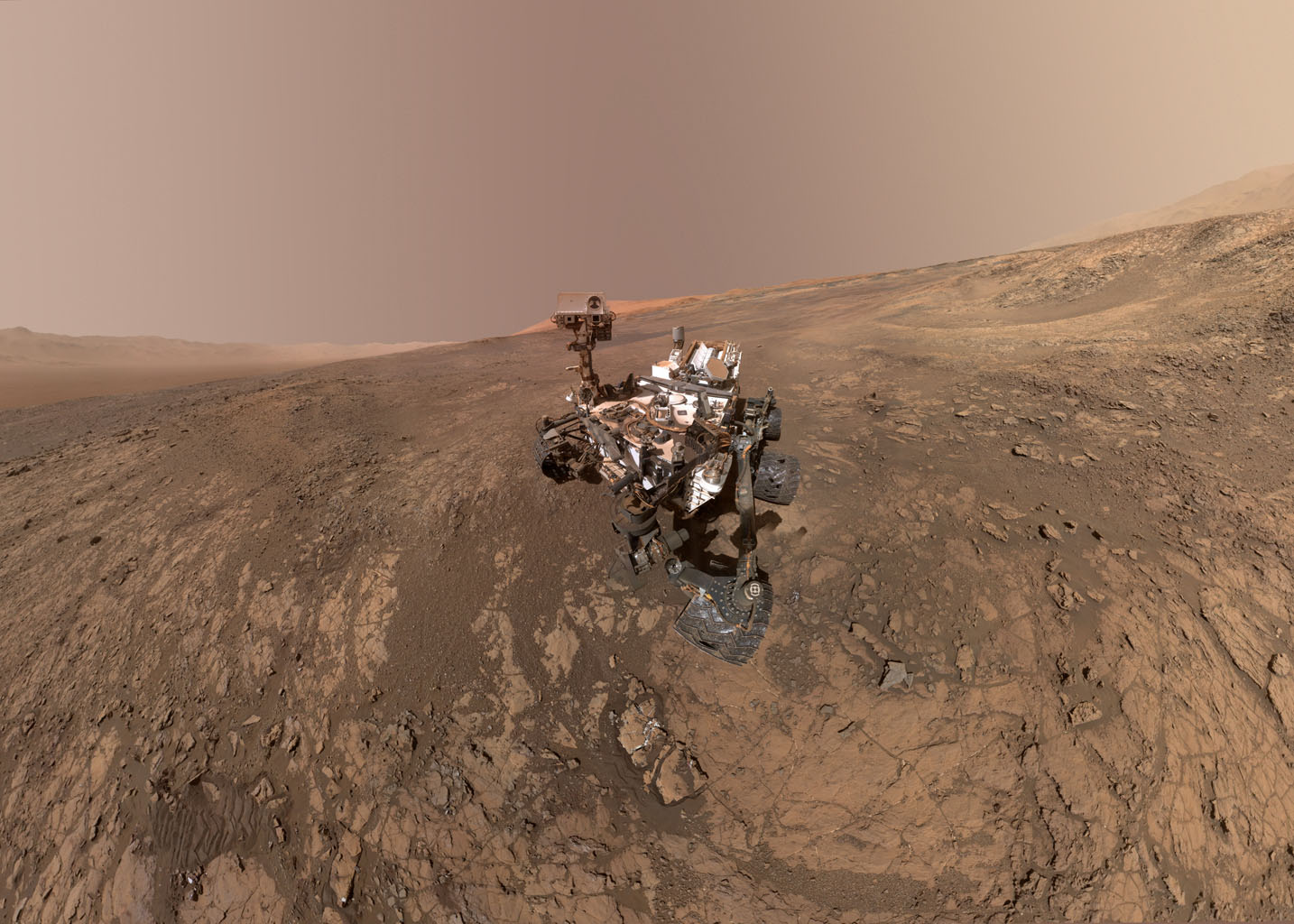 |
|||||||||||||||||
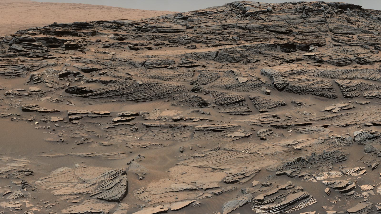
 Lovely image of sedimentary rocks on Mars |
|||||||||||||||||
 The floor of Gale crater below Curiosity |
|||||||||||||||||
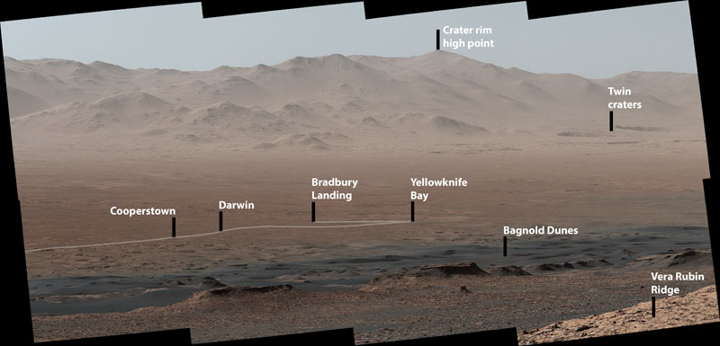 The journey so far - Jan 2018 |
|||||||||||||||||
 taken by me - Mars closest to Earth |
 Mars left, and the moon |
||||||||||||||||
Feb 18th 2021 Perseverance successfully lands on Mars|
https://www.youtube.com/watch?v=4czjS9h4Fpg Landing views onboard
cameras |
|
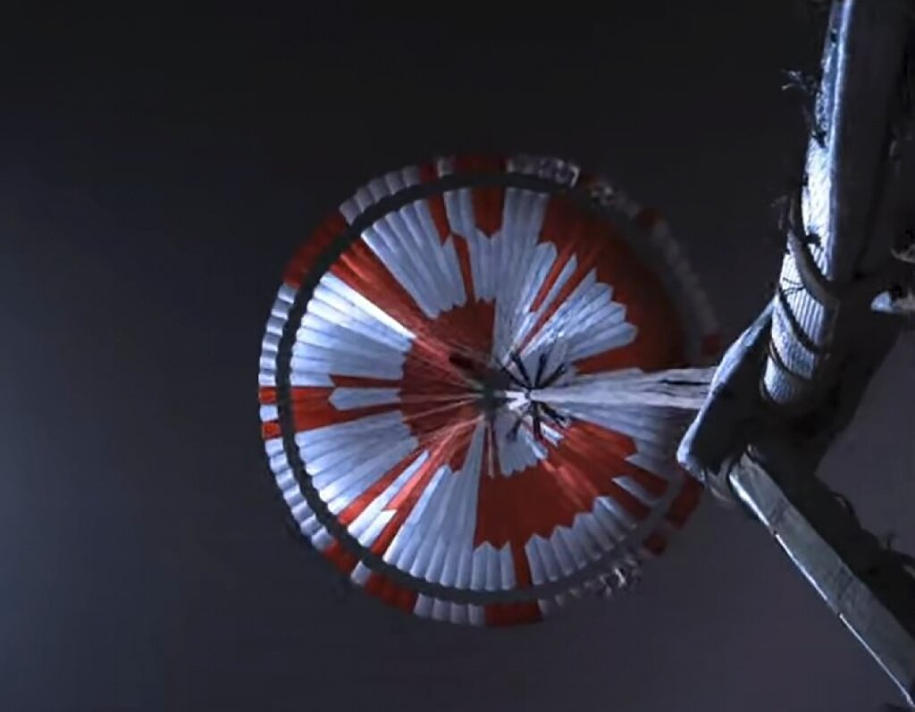 Chute open, descending. Colour code matches binary and says the JPL Motto - 'Dare Mighty Things' and location on Earth.
|
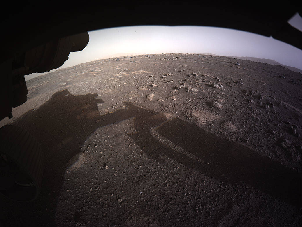 First colour image from Perseverance on landing |
|
|
|
|
| |||||||||
http://www.msss.com/msss_images/latest_weather.html Martian Weather Forecast
![]()